Brooks Peninsula Trip Report
At the end of August Bruce Kirkby and I had set our sites on paddling around the Brooks Peninsula on the west coast of Vancouver Island. Brooks Peninsula, also known as Mquq?in and part of the Quatsino and Kyuquot/Cheklesaht First Nations Territory is considered a unique geologic feature. As a result, the geology of the peninsula is different from that of the rest of Vancouver Island and many rare plant communities exist. It was thought that much of the Brooks has escaped the last Ice Age approximately 12,000 years ago. This remote wilderness area includes an extensive, wild ocean coastline, long sheltered inlets, rugged mountains, pristine estuaries with high waterfowl and fishery values and high biodiversity values associated with old-growth forests. Rounding Brooks is considered a formidable challenge to paddlers.
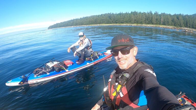
Bruce and I started in the river in San Josef Bay, at the exact location where we had finished our Cape Scott Expedition the summer before. We were motivated to link up more of the Vancouver Island coastline
I will let my paddling partner, the great story teller, Bruce Kirkby take you on our journey around the Brooks Peninsula.
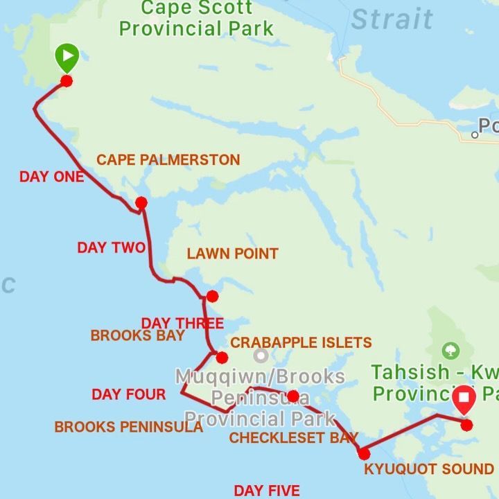
Brooks Expedition—DAY ONE—San Josef Bay to Quatsino Sound (47 km)
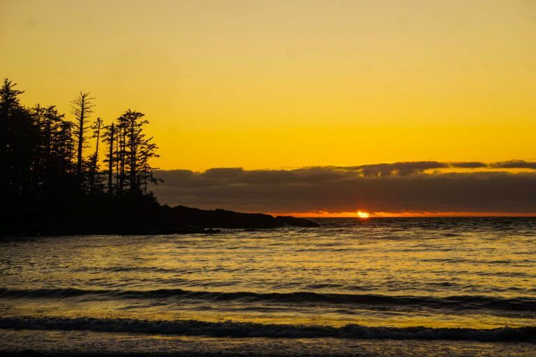
Last summer, after rounding Cape Scott, Norm Hann and I finished our paddle on the sandy beaches of San Josef Bay. Ahead of us–and clearly visible, despite lying over 100km away–loomed the Brooks Peninsula.
Jutting 13 km into the open Pacific, the Brooks is the most westerly point on Vancouver Island, with a reputation amongst mariners for severe winds, currents, weather and swell. John Kimantis, long-time chronicaller of kayak routes in the Pacific Northwest, warns: "The Brooks Peninsula is prone to high winds that can develop quickly. Rounding the Brooks is among the most challenging portions of BC coastline."
For a year, the Brooks lingered in our imaginations.
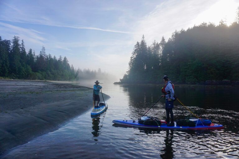
Late this August, Norm and I returned to San Josef Bay, and after loading boards with almost 100 lbs of food, water and gear, we paddled the lazy, tidewater river towards the outer sand beaches. After punching through waist-high surf, we turned south, swept onwards by an ebbing tide and a building northwesterly wind, travelling far offshore, past the rocky shores and breaking waves of Cape Palmerston.
Six hours later, we slipped into the protected waters of Quatsino Sound—pleased, exhausted, yet keenly aware the greatest challenges still lay ahead…
Paddling the San Josef River. PC: Bruce Kirkby
Neil saying goodbye to Bruce and I. Thank you Neil for the shuttle and pick up!
Paddling Around Cape Palmerston PC: Bruce Kirkby
Quatsino Campsite Day 1
Brooks Expedition—DAY ONE (cont)
In the waters off Cape Palmerston, we came across two ocean sunfish, or mola mola. These extraordinary creatures, which we are still learning about today (they don't just eat jellyfish, and they can indeed swim rather than simply drift) often exceed 8 feet in length and have grown to over 1000kg (2200 lbs)
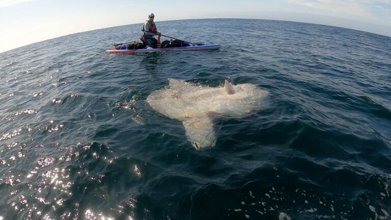
One of two Mola Mola we came across on the outside of Cape Palmerston and Top Knot Point.
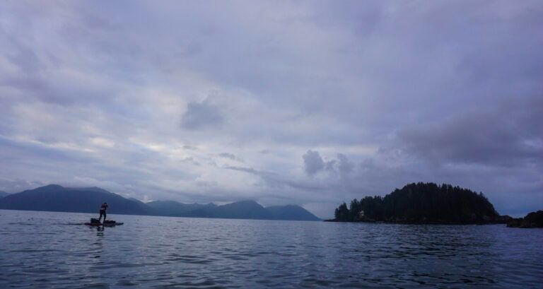
DAY TWO – Brooks Expedition – Quatsino Sound to Heater Point (27km)
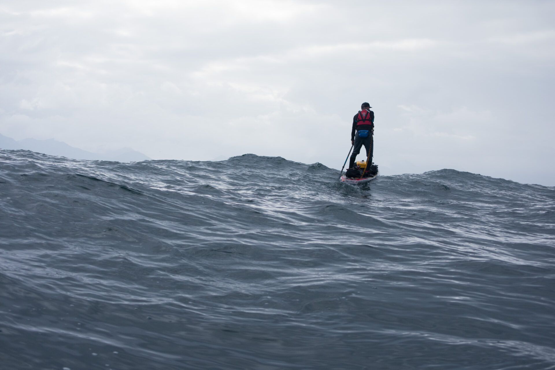
On the water early, we pushed across the mouth of Quatsino Sound, into darkening skies and building swell. By the time we reached the headland of Lawn Point, the seas were 3 metres, and confused. Echoes rumbled across the waters as dark waves heaved themselves skywards, then collapsed in explosions of spray along the rocky shores. A coast guard cutter appeared, then vanished over the horizon behind, leaving us wondering if they even saw us–a reminder of just how tiny we were amid the vast ocean.
Despite sticking close, Norm vanished frequently, lost behind lumps, reappearing below me in a trough, or balanced against the sky above. A wane sun kissed the waters for a fleeting moment, but the day grew steadily more blustery and damp. Alone with our thoughts, tossed by waves and wind, the situation never felt dire. But during those hours, my mind never wandered, not for a second. We had entered a state of hyper-awareness or constant-vigilance that I'm sure many mountaineers and outdoors enthusiasts can appreciate; an understanding that while the situation may be manageable, things could change quickly. Best pay attention.
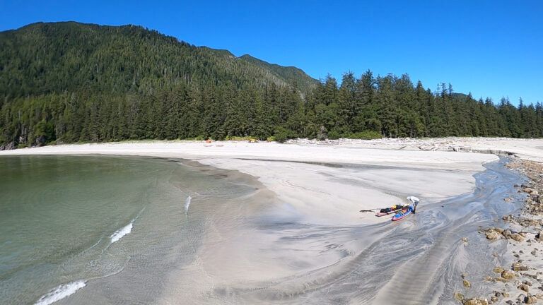
Upon crossing the mouth of Klaskino Inlet, we took shelter in the lee Heater Point, landing in low surf. The landscape was wild and windswept. We'd passed through a portal—the waters of Lawn Point proving more than we'd bargained—and with that came an unspoken awareness: There was no going back now; the only way out was through.
Morning departure from Kains Beach, Quatsino Sound.
Full on focus coming around Lawn Point PC: Bruce Kirkby
Disappearing in the groundswell. PC: Bruce Kirkby
Bruce, safely around Lawn Point, headed to Heater Point.
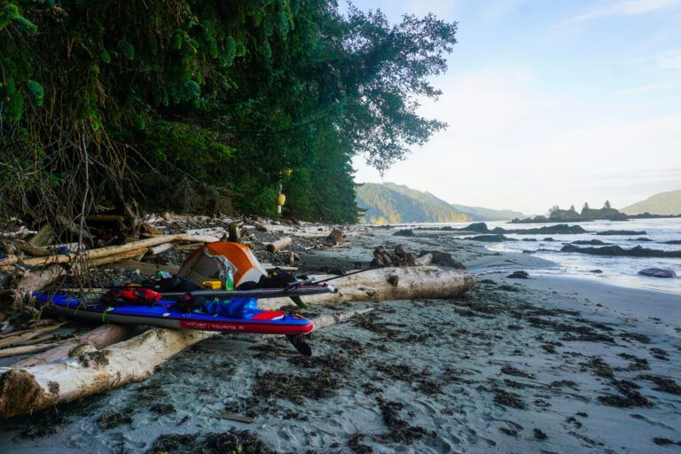
Heater Point Campsite
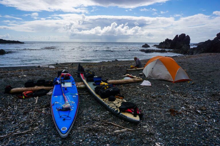
DAY THREE—Brooks Expedition—Heater Point to Crabapple Islets (18km)
The ocean settled overnight…a bit. With warm sun and clearing skies we set off towards the Crabapple Islets–the final possible landing point, and strategic launch site for paddlers hoping to round the Brooks. The morning was glorious, but with confused swell and clapitis rebounding in every direction, the passage across Brooks Bay demanded constant attention.
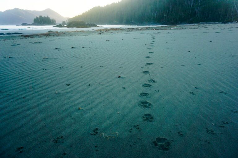
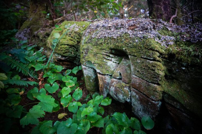
By 10am we'd landed on a windswept beach, sheltered from the full brunt of the Pacific by the Crabapple Islets. The rest of the day was spent relaxing, eating and beachcombing. A pack of wolves had passed recently, the prints yet unaffected by rain and shifting sand. The landscape was indescribably primal ; massive trees and house-high salal (bush) blow into tortured shapes by constant wind and storm.
We planned to rise before the sun the next morning to catch an ebb tide around the Brooks. Our VHF radio announced two days of favorable NW winds. But on the third morning, the winds would back to gale force SE. If everything went according to plan, we could just slip around the Brooks and race down the coast to the safety of Kyuquot Sound before the first storm of fall turned the ocean untravelable. But the window was tight, and many challenges still lay ahead. We fell into a fitful sleep with the tent shaking in 25kn winds and the ocean around us a sea of whitecaps.
Morning light coming up over the Brooks as we head to Crabapple Islets. PC: Bruce Kirkby
Clouded Mt. Doom on the Brooks watching over Bruce.
Entering the beach at Crabapple Islet. PC: Bruce Kirkby
Camp at Crabapple Islets/Brooks Peninsula , one of the most beautiful, raw and rugged places I have been to on the coast.
An incredible end to our day on the north side of Brooks.
Land of the Coastal Wolf, a morning visit past our tent.
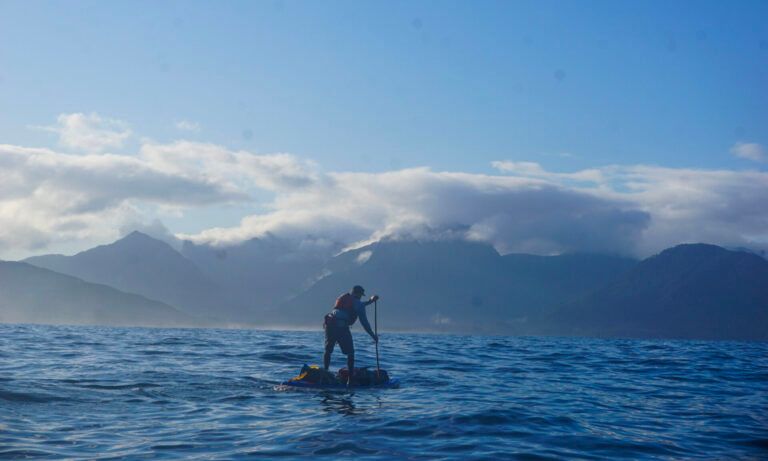
DAY FOUR—Brooks Expedition—Crabapple Islets to Acous Peninsula (42km)
Up in darkness, we brewed coffee and oatmeal, loading the boards as dawn broke. Conditions looked good, but still, a sense of gravity marked our launch-the route ahead was committing.
Mquq?in—as the Brooks Peninsula is known to Che:k'tles7et'h' people—means 'The Queen'. To the Koskimox, it is 'Where the Wind is Born.' Captain Cook described it as the 'Cape of Storms.' Perfectly rectangular, it juts far into the Pacific, dividing weather systems on Vancouver Island. Its 10 km wide headland is delineated by Cape Cook to the north and Clerke Point on the south.
The first two hours passed quickly. With low swell, we tucked inside offshore reefs, working ourselves steadily westwards. Sunlight sparkled off undulating waters, while the Brooks lingered in shadow.
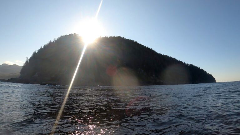
Suddenly the dark cliffs of Cape Cook reared before us, skyline crowded with Sitka spruce. Three enormous dark waves rose, and passed beneath us. Beyond lay beds of bull kelp, the scale of which I have never witnessed before. Then Solander appeared, kissed by the morning sun. This craggy, pyramidal island–an internationally significant seabird sanctuary–lies 1.5 km off the tip of the Brooks, and looks like it belongs on a Star Wars set.
For a short time we stood silently, trying to drink the moment in, balanced at this rarely-glimpsed precipice of extraordinary beauty that we might never return to. Also, as we well knew, a place capable of sudden and unspeakable ferocity.
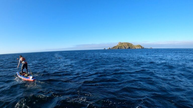
There was no time to linger. It was only 8-o-clock, but already winds were gusting to 25 knots. Without a backwards glance, we pointed our boards south, and focused on the task at hand. Two hours later, a building ebb and NW winds had carried us past the reefs of Clerke Point, into the relative safety of Checkleset Bay. We eventually stumbled ashore on the sand beaches of Jacobson Point, devoured a lunch of cheese and pepperoni, then carried on towards the tranquil islets of the Acous Peninsula…
Sunrise over Cape Cook, Brooks Peninsula.
Bruce, after a long journey to this point, making his way around Brooks with Solander Island in the distance.
Enjoying the moment rounding the Brooks.
A nice break on the calm waters at Clerke Point and entering into Checkleset Bay.
Lunch stop at Jacobson Beach, Brooks Peninsula.
Mortuary Pole on the Acous Peninsula.
Stellar Sea Lion skeleton at the Acous campsite. PC: Bruce Kirkby
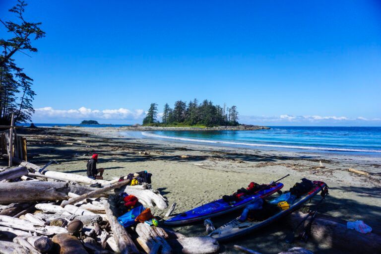
FINAL DAYS – Brooks Expedition – Acous Peninsula to Spring Island
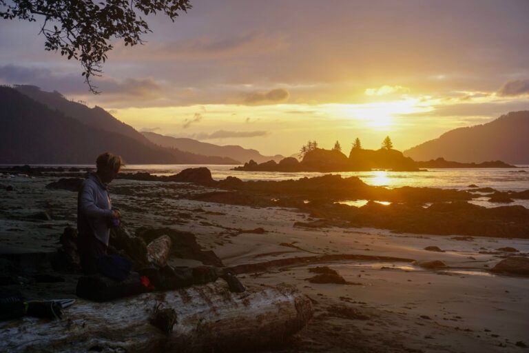
With the tension of the Brooks behind us, we enjoyed an easy day crossing the calm waters of Checklesat Bay, passing sea otters, porpoises and countless jellies. At the lonely Thomas Islets, Norm spotted a dead humpback on a secluded beach, and stopped to strap an enormous rib bone (80 lbs and shoulder high) on the back of his paddleboard–a gift for his son! With a SE storm bearing down on the coast, we took refuge at the camp of my old buddy Dave Pinel and West Coast Expeditions on Spring Island.
After warm showers, a stunning meal (cooked by the 2-star Michelin chef at Dave's camp), we helped the crew start their end-of-season pack up , then caught a boat ride to Fair Harbour, where the illustrious Neil Gilson, was waiting with one of his patented mixology treats, and a ride back to 'civilization.'
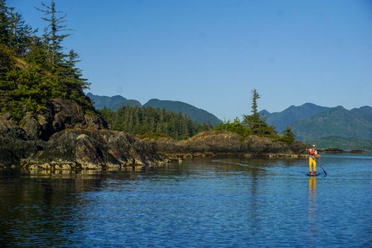
Paddling the Acous Island
The vertebrae of a Humpback Whale found on Thomas Island PC: Bruce Kirkby
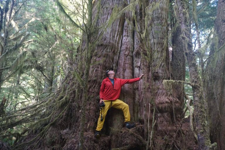
Incredible Old Growth forest elder on Spring Island.
A big thanks to Dave Pinel and his staff at West Coast Expeditions, Spring Island.
For several summers, Norm Hann and I have tackled increasingly challenging paddleboard expeditions together–sure, because we love being out there, but also because of the joy and excitement that comes from expanding our understanding of what paddleboards are capable of in serious expeditions settings. (And what we are capable of too!) It has been hugely rewarding for both of us to see the comments and interest in our trips. Thank you from both of us, for taking time to come on this coastal journey with us amid the busyness of modern life. I plan on posting some packing tips and lists soon-but in the meantime, never hesitate to ask if you have questions.
What a finish in Fair Harbour! Thank you Neil! Cheers to a great adventure and safe passage! PC: Bruce Kirkby
Finally, a massive thanks to the incredible team who support our endeavours. We simply couldn't do it without you, Starboard SUP, Sunova SUP, Blackfish Paddles, Astral Footwear, MEC, Mustang Survival.
And a big thanks to Bruce Kirkby for his amazing storytelling and for being such a great partner out on the expedition. If you are interested in reading Bruce's books visit your local bookstore or order online. Check out his most recent book Blue Sky Kingdom, and previous books Dolphin's Tooth and Sand Dance. You can follow Bruce here.
Recent Posts